What's in this note
- The short answer: flood zones by zip code
- What a flood zone actually is
- Why “by zip code” is the wrong unit of measurement
- Reading the zone letters: the A-family, inland high risk
- Reading the zone letters: the V-family, coastal high risk
- The moderate-to-minimal risk zones: B, C, and X
- Zone D: areas of undetermined risk
- The Special Flood Hazard Area and the one percent annual chance, decoded
- How to look up your flood zone, step by step
- Reading a Flood Insurance Rate Map panel
- Your lender’s flood zone determination, and why it can differ from your own lookup
- Base flood elevation and why it matters once you know your zone
- What your zone means for whether flood insurance is required
- What your zone means for price
- When zones change: map revisions
- Letter of Map Amendment and Letter of Map Revision: correcting a zone
- Common mistakes people make looking up a flood zone
- If you believe your zone is wrong
- A worked example: two homes, one zip code, two zones
- How this note differs from our other flood notes
- The bottom line
Short answer: You cannot reliably get a flood zone from a zip code alone. Flood zones are mapped parcel by parcel against terrain and water, not against postal boundaries, so a single zip code commonly contains several zone letters at once. The free FEMA Flood Map Service Center returns your actual zone when you enter your full street address, and that letter, not your zip code, is what decides whether flood coverage is likely required and roughly how it is priced.
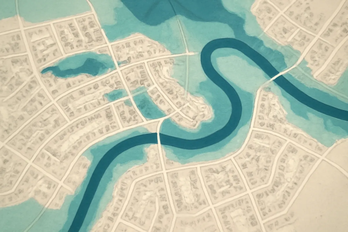
Flood zones by zip code is a search people run for a genuinely reasonable reason: they want a fast answer to “am I at risk,” and a zip code feels like the natural unit to search with, since it is the geography most people have memorized. The honest answer is that zip code is the wrong tool for this particular question. A flood zone is drawn around a river, a coastline, or low-lying terrain, and those lines do not respect postal routes. Two houses three streets apart, sharing the same zip code and the same mail carrier, can sit in completely different flood zones with completely different insurance consequences.
This coverage note is built around that correction. It walks what a flood zone actually is and where the maps come from, why zip code is too coarse a unit and what to search instead, how the zone letter system works across every category from high-risk coastal to undetermined, how to run the real lookup step by step, how to read what comes back, what a lender’s own determination adds to the picture, when and how zones get corrected or revised, and the mistakes that trip people up along the way. For the price a zone implies, our note on how much flood insurance costs picks up where this one leaves off, and for the mandatory-purchase mechanics in a high-risk zone specifically, our note on flood insurance for high-risk areas goes deeper. Run your own zone and coverage amount through the companion below as you read.
Key takeaways
- A zip code is a postal boundary, not a flood boundary, and a single zip code commonly contains several different flood zones at once.
- The free FEMA Flood Map Service Center returns your actual zone when you enter your full street address, not your zip code or city alone.
- Zone letters sort land into families: A-family and V-family are high-risk, B, C, and X are moderate-to-minimal risk, and D is undetermined because no detailed study has been done.
- Your zone, not your zip code, decides whether a federally backed mortgage requires flood coverage and roughly what that coverage tends to cost.
- Flood maps are revised periodically, and a parcel can be moved into or out of a high-risk zone, so a lookup done years ago is worth re-checking.
The short answer: flood zones by zip code
Here is the whole subject compressed before it gets unpacked. Searching “flood zones by zip code” is a natural instinct, but a zip code is a mail-delivery boundary that can span many square miles and thousands of individual parcels, while a flood zone is a line drawn around terrain and water that can change from one side of a street to the other. The two geographies rarely line up. What you actually want is a parcel-level lookup, and the free tool for that is the FEMA Flood Map Service Center, where entering your full street address returns the specific zone letter assigned to your home.
Once you have that letter, three things follow from it. First, whether a federally backed mortgage is likely to require you to carry flood insurance. Second, roughly what tier of premium that coverage tends to fall into, since the zone is the single biggest price driver. Third, whether your homeowners policy, which excludes flood everywhere regardless of zone, leaves you with a real gap worth closing even where coverage is not required. Every dollar figure later in this note is illustrative, chosen to show the shape of the relationship rather than to price your address.
What a flood zone actually is
A flood zone is a risk category that the Federal Emergency Management Agency assigns to a specific piece of land, published on a Flood Insurance Rate Map for the community it sits in. FEMA studies the terrain, the nearby rivers, lakes, or coastline, historical flood data, and engineering models of how water would move across the land during a serious storm, then draws boundary lines separating areas by expected flood frequency and depth. Everything inside a given boundary gets the same letter, and that letter is what insurers, lenders, and local building departments use as shorthand for the risk.
The map is not a prediction of where water will go next year. It is a probability-based classification built from the best available terrain and hydrology data at the time of the study, intended to answer a narrower question: over a long span of time, how likely is this specific piece of ground to be reached by a serious flood. That narrower, statistical framing is also why the maps get revised periodically rather than treated as permanent, a point this note returns to later.

Why “by zip code” is the wrong unit of measurement
The instinct to search by zip code makes sense, because zip code is the geography most people can recall without checking anything. The problem is what a zip code actually is: a boundary the postal service drew for mail routing efficiency, with no relationship to rivers, elevation, or coastline. A zip code can run for miles along a highway, include an entire small town, or straddle a creek that only threatens the lowest-lying third of the addresses inside it. None of that geography maps cleanly onto a flood boundary, which follows water and terrain instead.
The practical consequence is that a zip code almost never corresponds to a single flood zone. It typically contains a mix: a thin high-risk band hugging the water, a larger moderate-risk area nearby, and often a large share of minimal-risk land making up the rest. Two neighbors who share a zip code, a mail carrier, and a school district can hold completely different flood zones, different mandatory-purchase requirements, and different illustrative premium bands, because the zone follows the contour of the land under each house, not the postal boundary around the neighborhood.
Illustrative zone-letter mix inside one example multi-zone zip code
A single hypothetical zip code that touches a river, built to illustrate how unevenly zones distribute inside one postal boundary. This is one made-up example for illustration, not a real zip code or a national average.
The shape is the point, not the exact split: a zip code that touches water tends to hold several zones at once, so a single answer for the whole zip code would be wrong for most of the addresses inside it.
Reading the zone letters: the A-family, inland high risk
Zones whose label begins with A are high-risk inland areas, the land expected to be reached by a flood from a river, lake, or other watercourse with at least a one percent chance in any given year. The plain letter A appears where no detailed engineering study has set a specific flood elevation. AE is the most common high-risk label nationally, and it comes with a published base flood elevation, the specific height the mapped flood is expected to reach, which insurers use to price the home. AO applies to areas that face shallow, sheet-style flooding, commonly near the base of a slope, and is labeled with an expected depth rather than an elevation. AH applies to shallow ponding areas with defined depths, typically one to three feet.
All four A-family labels sit inside the Special Flood Hazard Area, the formal high-risk designation, and all four carry the same basic consequence: if you have a federally backed mortgage, flood coverage is very likely required, and the premium reflects a meaningfully elevated risk. The practical difference between the sub-labels is mostly about how the flooding behaves, rising river water versus shallow ponding, rather than about whether coverage applies. Our note on flood insurance for high-risk areas walks the mandatory-purchase mechanics for this family in full.
Reading the zone letters: the V-family, coastal high risk
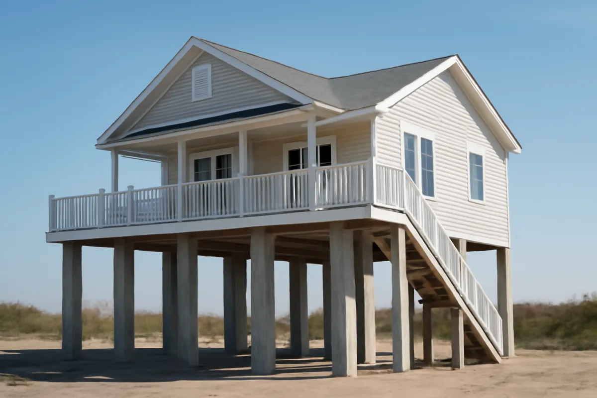
Zones whose label begins with V are high-risk coastal areas, exposed not just to rising water but to wave action and storm surge on top of it, which is why they are consistently the most expensive family to insure. The plain letter V applies where no detailed coastal study has set a specific elevation, while VE, the more commonly seen label, comes with a published base flood elevation the same way AE does inland. The added wave-action exposure is what separates a V-family zone from an A-family zone that otherwise looks similar on a map: both are flood-prone, but V-family land also has to withstand the mechanical force of breaking waves, which does more structural damage to a building than rising water alone.
Like the A-family, V-family zones sit inside the Special Flood Hazard Area, so the same mandatory-purchase logic applies for a federally backed mortgage. What changes is the price: on an illustrative model, a coastal VE zone commonly prices well above an inland AE zone carrying an identical coverage amount, because the expected loss per claim is larger. If your address returns a V-family letter, elevation above the base flood elevation, documented with an elevation certificate, is typically the single biggest lever on the resulting premium.
The moderate-to-minimal risk zones: B, C, and X
Outside the Special Flood Hazard Area sit the B, C, and X zones, sometimes shown on older maps as a shaded or unshaded X. These are the moderate-to-minimal-risk areas, the land FEMA’s study did not place inside the one percent annual chance floodplain. The label that trips people up is “minimal,” because it reads as “none,” and that is not what the map is saying. A B, C, or X zone still floods, measurably less often than a Special Flood Hazard Area, but a large share of flood claims nationally come from exactly these zones, because so much more of the country’s housing sits in them.
The practical upside of landing in one of these zones is twofold. A federally backed mortgage generally does not require flood coverage here, and where coverage is purchased, it is commonly eligible for a lower-cost preferred-risk style policy rather than the pricing a Special Flood Hazard Area carries. The practical trap is treating “not required” as “not needed.” Our note on how much flood insurance costs walks the illustrative premium bands by zone in detail, and the gap between a minimal-risk premium and the cost of an uninsured basement flood is usually the more useful comparison than the gap between zones.
Zone D: areas of undetermined risk
Zone D is different from every other label on the map, because it is not a statement about risk at all, it is a statement about the absence of a detailed study. FEMA assigns Zone D to areas where no engineering-level flood hazard analysis has been completed, which happens most often in rural or sparsely developed parts of the country where funding a full study has not been a priority. The honest description of a Zone D property is “unknown,” not “safe.”
That distinction matters practically in two ways. A federally backed mortgage does not automatically trigger the mandatory-purchase requirement in Zone D the way it does in a Special Flood Hazard Area, since the requirement is tied to the mapped designation rather than to a general sense of risk. But some lenders apply extra scrutiny here precisely because the map cannot rule anything out, and private flood insurers vary in how they price or even offer coverage for a Zone D address. If your lookup returns Zone D, the honest next step is asking a local agent what is actually available, rather than reading the absence of a high-risk label as reassurance.
The Special Flood Hazard Area and the one percent annual chance, decoded
The A-family and V-family zones together make up what FEMA formally calls the Special Flood Hazard Area, the land expected to be reached by a flood with at least a one percent chance of happening in any given year. That one percent figure is also called the hundred-year flood, a phrase that misleads almost everyone who hears it. It does not mean a flood that happens once a century, and it does not mean you are safe for ninety-nine years after one occurs. It is an annual probability, repeated every single year regardless of what happened the year before.
Compounded over the length of a typical mortgage, that one percent annual figure works out to roughly a 26 percent chance of at least one such flood over 30 years, which is a meaningfully higher number than the calm-sounding hundred-year label suggests. Knowing your zone letter and translating it into that compounded, mortgage-length framing is a more useful mental model than treating the zone as a yes-or-no switch. Our note on flood insurance for high-risk areas carries this math further for anyone whose address lands inside the Special Flood Hazard Area.
How to look up your flood zone, step by step
Start with the free federal source rather than a third-party site, since it is the one every lender and insurer ultimately checks against. Go to the FEMA Flood Map Service Center and enter your complete street address, including unit number if you live in a multi-unit building, rather than just your city or zip code. The tool returns a FIRMette, a snapshot of the official map panel covering your parcel, along with the zone letter assigned to it and, for an A-family or V-family zone, the base flood elevation.
A few details are worth confirming while you are there. Check that the effective date shown on the map panel is current, since an outdated cached result can lag a recent revision. If your address sits near a zone boundary line on the map image, note that the line’s exact position matters more than it might seem, since a parcel on one side of it can carry a materially different requirement than a parcel a short distance away on the other side. Save or screenshot the FIRMette, because an insurance agent or lender will often ask for it directly rather than re-running the same lookup themselves.
Reading a Flood Insurance Rate Map panel
The map panel you get back is more than just a colored zone. It shows your parcel’s position relative to the mapped floodplain boundary, the panel number and effective date that identify exactly which version of the map you are looking at, and, in an A-family or V-family zone, the base flood elevation in feet, the height the mapped flood is expected to reach at that location. Street names and a scale bar orient the image to the ground.
Two things commonly confuse a first-time reader. First, the zone boundary line is drawn at a specific resolution, and a parcel that straddles it is assigned based on where the structure itself sits, not based on the parcel’s overall shape, which is one reason a surveyor’s input matters for a borderline property. Second, the base flood elevation is a height above a stated vertical reference, not a height above your own yard, so comparing it to your home’s actual lowest floor requires a professional elevation certificate rather than a guess. Our note on flood insurance for high-risk areas covers what that certificate does and when it is worth commissioning.
Your lender’s flood zone determination, and why it can differ from your own lookup
If you have a mortgage, your lender ordered its own flood zone determination when the loan closed, a formal product pulled from the same underlying FEMA data but packaged for the mortgage file and kept current through a monitoring service for the life of the loan. In the overwhelming majority of cases, the lender’s determination and your own address-level lookup on the Flood Map Service Center will agree, since both draw on the same federal maps.
The two can diverge in a few specific situations worth knowing about. A map revision that took effect after your loan closed may be reflected in your lender’s monitored determination before it shows up anywhere you would personally think to check again. A parcel near a boundary line can occasionally be read differently depending on exactly how the structure’s footprint is plotted against the line. And a Letter of Map Amendment obtained after closing needs to be forwarded to the lender directly, since it will not automatically update their file. If your own lookup and your lender’s determination disagree, ask the lender which version their requirement is based on and why, rather than assuming either one is automatically correct.
Base flood elevation and why it matters once you know your zone
Once you know your zone letter, the base flood elevation is the next piece of information worth having, and it only applies in an A-family or V-family zone. It is the height, measured against a fixed vertical reference, that the mapped flood is expected to reach at your specific location. The number by itself tells you little. What matters is how your home’s lowest floor compares to it, which is exactly what an elevation certificate, a form completed by a licensed surveyor or engineer, is built to document.
A home whose lowest floor sits above the base flood elevation floods less often and less deeply than an identical home sitting below it, and that difference is one of the largest levers on a flood insurance premium in a high-risk zone. It can also matter for building decisions: a substantially damaged home in a Special Flood Hazard Area is often required to be rebuilt at or above the base flood elevation under local floodplain rules, which is a separate requirement from the insurance question but flows from the same number. Our note on flood insurance for high-risk areas walks the elevation certificate process and what it tends to cost.
What your zone means for whether flood insurance is required
The single most consequential thing your zone letter does is answer a yes-or-no question: if you have a mortgage from a federally regulated or insured lender, does federal law require you to carry flood insurance. The rule is tied directly to the Special Flood Hazard Area designation. If your parcel falls inside an A-family or V-family zone and you carry a qualifying mortgage, the lender must require flood coverage for the life of the loan, at least up to the loan balance or the maximum available coverage, whichever is less. Outside the Special Flood Hazard Area, in a B, C, X, or D zone, the federal requirement generally does not apply, though an individual lender can still choose to require it in some cases.
Illustrative likelihood a federally backed mortgage requires flood coverage, by zone family
A rough, illustrative sense of how the mandatory-purchase rule tracks the zone family. Individual lender practice can vary at the margins, and this does not describe any one loan.
Bars are scaled to the ~98% top figure. The jump between the moderate-risk zones and the two Special Flood Hazard Area families is the real story: the requirement is close to automatic once a mortgaged home sits inside an A-family or V-family zone.
If you own your home outright, no federal rule forces the purchase regardless of zone, though the underlying flood risk that would have triggered the requirement has not gone anywhere. Our note on flood insurance for high-risk areas walks the requirement’s mechanics, including why it is a floor rather than a ceiling on how much coverage you should actually carry.
What your zone means for price
Alongside the requirement question, your zone is also the single biggest factor in what a flood policy tends to cost. On an illustrative pricing model, a minimal-risk X zone and a high-risk coastal VE zone can differ by several multiples on an identical coverage amount, which is why a national average premium describes almost no individual home well. Elevation within the zone, the amount of building and contents coverage you choose, and your deductible all move the number further from there, but the zone sets the starting band before any of those refinements apply. Sketch a rebuild figure with our replacement-cost estimator before you price a building-coverage amount against it.
This note deliberately does not repeat those premium tables, since our dedicated note on how much flood insurance costs prices an illustrative range by zone end to end, and our note on flood insurance for high-risk areas does the same specifically for the Special Flood Hazard Area. What belongs here is the link between the two subjects: you cannot usefully estimate a flood premium until you know the zone, and the zone is exactly what a zip-code-level search cannot reliably give you. Set your zone and a coverage amount in the companion below for a rough illustrative band once you have looked up the real letter.
When zones change: map revisions
A flood zone assigned today is not necessarily the zone assigned in ten years, because FEMA periodically re-studies watersheds and coastlines and issues revised Flood Insurance Rate Maps. A revision can move a parcel from a moderate-risk zone into the Special Flood Hazard Area, or the reverse, and the triggers are varied: new engineering models with better elevation data than the original study used, upstream development that changes how water drains, a shifting river channel, or coastal erosion that moves the effective shoreline.
The consequence for a homeowner can be abrupt. A property that has been Zone X for decades can be remapped into an AE or VE zone, which, for anyone carrying a federally backed mortgage, can introduce a mandatory-purchase requirement with comparatively little personal warning, often announced through a community-wide notice rather than anything addressed to you individually. Two protections soften this in general terms: buying coverage before a pending revision takes effect can sometimes secure more favorable treatment than waiting, and some remapped properties qualify for grandfathering provisions that preserve an older, lower-risk rating for a time. The specifics of both change and are set by FEMA, so confirm current rules with an agent rather than relying on a general description.
Letter of Map Amendment and Letter of Map Revision: correcting a zone
If you believe your specific parcel has been mapped into the wrong zone, perhaps because the lot was graded or filled above the surrounding terrain after the underlying study was completed, FEMA has a formal mechanism to correct it. A Letter of Map Amendment addresses a property that was likely always on naturally high ground relative to the mapped boundary, while a Letter of Map Revision addresses a change caused by an actual physical alteration to the land, such as a fill project or a drainage improvement. Both require elevation data prepared by a licensed surveyor or engineer, submitted through a defined application process, and both can carry a real cost for the survey work itself.
This is a documentation process, not an appeal based on the home never having flooded or on a general sense that the map looks wrong. FEMA reviews the submitted elevation data against its own models and either issues the amendment or does not. If the request succeeds, the letter becomes part of the official record for your parcel and can remove a mandatory-purchase requirement or shift your pricing tier going forward. Start by asking a flood-insurance agent or your local floodplain administrator whether your situation is a plausible candidate before commissioning a survey, since the elevation data has to clearly support the correction.
Common mistakes people make looking up a flood zone
A short list of mistakes accounts for most of the bad information people end up acting on. Searching only a zip code or a city name, rather than a full street address, is the one this note is built around, and it returns a general sense of an area rather than a parcel-specific answer. Assuming a neighbor’s zone applies to your own address is a close second, since a boundary line can run directly between two adjacent lots. Treating “not in a high-risk zone” as “flood cannot happen here” ignores that a meaningful share of claims nationally come from moderate-and-minimal-risk zones.
Relying on a lookup done years ago, rather than re-checking after a known map revision, is another common gap, since the letter you were told at closing is not guaranteed to still be current. And confusing a paid third-party site’s repackaged data with the authoritative federal source can leave you working from a stale or mis-scraped result when the free, current version was available the whole time. Running the real address-level lookup on the Flood Map Service Center, and re-running it periodically, avoids all five at once.
If you believe your zone is wrong
Start with confirmation, not assumption. Re-run the address-level lookup carefully, checking that you entered the exact address including any unit number, and compare the result against your lender’s determination if you have one. If both agree and the result still seems implausible given what you know about your lot’s elevation, the next step is a conversation with a flood-insurance agent or your local floodplain administrator about whether a Letter of Map Amendment or Revision is a realistic path, and what elevation survey it would require.
What does not work is simply declining to carry coverage because you personally disagree with the map, if you are in a situation where a federally backed mortgage ties the requirement to the zone. The map, not your own assessment, is the document lenders and insurers rely on until it is formally corrected through the FEMA process. If the zone turns out to be accurate after all, use the time you spent investigating it to size the coverage properly instead, which our note on how much flood insurance you need walks through.
A worked example: two homes, one zip code, two zones
Put the pieces together on one illustrative pair of addresses. The Alvarez and Chen households live four streets apart, inside the same zip code, served by the same mail carrier and the same elementary school. The Alvarez home sits two blocks from a creek that floods during heavy regional storms, on land the FEMA study places inside an AE zone with a published base flood elevation. The Chen home sits on higher ground closer to the center of the neighborhood, mapped as Zone X, outside the Special Flood Hazard Area entirely.
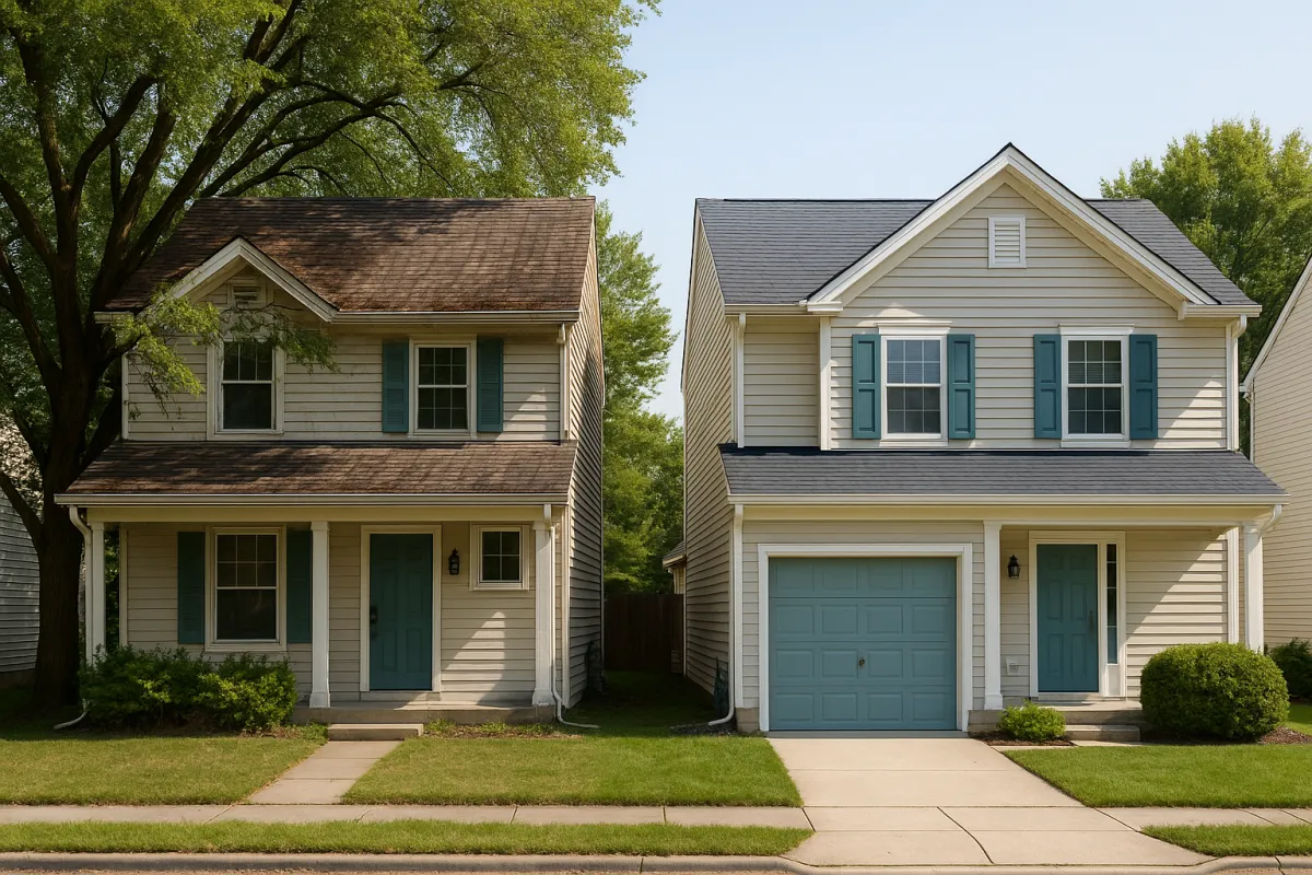
Both households carry a federally backed mortgage. For the Alvarez home, in the AE zone, flood coverage is very likely required, and on an illustrative pricing model their premium would land in the moderate-high range this note’s companion sketches for an inland high-risk zone. For the Chen home, in Zone X, no federal requirement applies, and if they choose coverage anyway it would price at the low end of the same illustrative model. Both households share a zip code, a mail route, and a school zone. Neither fact says anything about either one’s flood zone, which is the entire point: the zip code they share predicts nothing, and the address-level lookup each household ran separately is what actually answered the question.
How this note differs from our other flood notes
Flood insurance raises several distinct questions, and it helps to know which note answers which. This one is specifically about identification: what a flood zone is, why a zip code cannot reliably tell you yours, how to run the real lookup, and how to read what comes back. If your question is instead the price a known zone implies, our note on how much flood insurance costs prices illustrative premiums by zone in detail. If your question is specifically about a high-risk Special Flood Hazard Area you already know you are in, our note on flood insurance for high-risk areas covers the mandatory-purchase rule, the NFIP versus private comparison, and the levers that lower the cost.
And if you are sizing how much building and contents coverage to actually carry once you know your zone, our note on how much flood insurance you need walks that separately. Kept together, the four notes cover the arc from identification through pricing through sizing, and the thread running through all of them is the same one this note opened with: your zone comes from your address, never from your zip code, and a real lookup takes less time than reading about why it matters.
The bottom line
Flood zones by zip code is the wrong search, even though it is the natural one to try. A zip code is a mail-delivery boundary with no relationship to terrain or water, and a single zip code commonly holds several different flood zones at once. The real lookup takes your full street address to the free FEMA Flood Map Service Center, which returns the actual zone letter assigned to your parcel, from the A-family and V-family high-risk zones that make up the Special Flood Hazard Area, through the moderate-to-minimal-risk B, C, and X zones, to the undetermined Zone D. That letter, not your zip code, is what decides whether a federally backed mortgage requires flood coverage and roughly what tier of premium it falls into. Run the real lookup, confirm it against a lender’s determination if you have one, re-check it after a known map revision, and once you know your zone, size the coverage with our flood insurance needs note, price it with our cost note, sketch a rebuild figure with our replacement-cost estimator, and run your own numbers in the companion below.
This coverage note is educational reading about how FEMA flood zones work and how to look yours up, not insurance, legal, or engineering advice, and it does not determine or confirm any specific address’s actual flood zone. The zone letter, the mandatory-purchase requirement, base flood elevations, and the Letter of Map Amendment and Revision processes are established and maintained by FEMA and the National Flood Insurance Program, change over time, and can differ by community and by individual parcel. Every percentage, premium band, and illustrative figure above is a hypothetical example built to show how the pieces relate, never a quote and never a statement about your address. Look up your own flood zone directly on the FEMA Flood Map Service Center, confirm it against your lender’s determination if you have one, and speak with a licensed flood-insurance professional or a surveyor before relying on anything here for your own property.
Frequently asked questions
What flood zone am I in?
The only reliable way to find out is to look up your exact street address, not your city or zip code, on the FEMA Flood Map Service Center, the federal government's free map tool. Enter your address, and it returns the flood zone letter assigned to your specific parcel, taken from the current Flood Insurance Rate Map for your community. Your mortgage lender, if you have one, will also have ordered its own flood zone determination as part of the loan, and a flood insurance agent can pull the same data. All three should agree, since they draw on the same federal maps, but the address-level lookup is the one you can do yourself in a couple of minutes. A zone letter is a risk category, not a certainty, so treat it as the starting point for a coverage decision rather than the whole answer.
Can I find my flood zone from my zip code alone?
Not reliably, and this is the single most common mistake in a zone lookup. A zip code is a postal delivery boundary set by the mail system, often covering several square miles and thousands of parcels, while a flood zone is a line drawn around terrain and water, often changing within a single block. A zip code that touches a river, a creek, or a coastline will typically contain a mix of zone letters inside it: some high-risk parcels near the water, and many more moderate or minimal-risk parcels a short distance away. Searching only your zip code on a map tool can return a general area rather than your parcel, which is why every official lookup asks for a full street address.
What do the flood zone letters mean?
The letters sort land into a handful of risk categories. Zones starting with A, such as A, AE, AO, and AH, are high-risk inland areas near rivers, lakes, and other watercourses. Zones starting with V, such as V and VE, are high-risk coastal areas that add wave action and storm surge on top of rising water. Zones B, C, and X are moderate-to-minimal-risk areas outside the high-risk designation, though they are not risk-free. Zone D marks an area FEMA has not studied in detail, so the risk is undetermined rather than known to be low. The A and V families together make up the Special Flood Hazard Area, the high-risk zone that drives most insurance requirements.
What is Zone D on a flood map?
Zone D is the label FEMA uses for an area where no detailed flood hazard analysis has been done, so the actual risk is undetermined rather than confirmed low. It shows up most often in rural or sparsely mapped areas where a full engineering study has not been funded. A federally backed mortgage does not automatically require flood insurance in a Zone D area the way it does in a Special Flood Hazard Area, but undetermined is not the same as safe, and some lenders apply extra caution in Zone D precisely because the map cannot rule out significant risk. If your address comes back as Zone D, ask your insurance agent whether private flood coverage is available for the area rather than assuming no study means no risk.
Is the FEMA flood zone lookup free?
Yes. The FEMA Flood Map Service Center is a free federal tool, and entering your address and reading the zone letter costs nothing. Your lender's flood zone determination is also typically bundled into the loan process at no separate cost to look up. A handful of third-party websites repackage the same public map data behind a paywall or a lead-generation form, which is worth knowing before you pay anyone for information the federal map center already provides for free. If a site asks for payment before showing a zone letter, go to the official Flood Map Service Center first and treat anything else as a convenience layer on top of it, not a separate source of truth.
Why does my flood zone matter for homeowners insurance, not just flood insurance?
Your flood zone does not change what a standard homeowners policy covers, because flood is excluded from that policy everywhere, regardless of zone. What the zone decides is whether a separate flood policy is optional or effectively mandatory, and it is one of the biggest factors in what that separate policy costs. If you have a federally backed mortgage and your zone sits inside the Special Flood Hazard Area, coverage is very likely required. Outside that designation it is usually optional, though a large share of flood claims nationally come from lower-risk zones. Our coverage notes on flood insurance for high-risk areas and on how much flood insurance costs pick up from here once you know your zone.
Can my flood zone be wrong, and how do I get it corrected?
Maps are drawn from terrain and elevation data at a point in time, and an individual parcel can occasionally be mapped into a zone that does not reflect its actual elevation, particularly if the lot was graded or built up after the underlying survey was done. If you believe this describes your property, FEMA has a formal process, commonly a Letter of Map Amendment or a Letter of Map Revision, that can move a specific parcel out of a mapped zone when supported by elevation data from a licensed surveyor or engineer. It is a documentation process, not an appeal based on opinion or on the home never having flooded, and it takes real paperwork and often a fee for the survey. Start the conversation with a flood-insurance agent or your local floodplain administrator before assuming the map is wrong.
Do flood zones change over time?
Yes. FEMA periodically re-studies watersheds and coastlines and issues revised Flood Insurance Rate Maps, and a revision can move a specific parcel into a higher-risk zone or out of one it used to sit in. Development upstream, changing river channels, coastal erosion, and simply better survey technology than the last study used are common reasons a remap happens. A home that was Zone X for decades can be remapped into an AE zone, which can introduce a mandatory-purchase requirement overnight for anyone with a federally backed mortgage. It is worth re-checking your zone every few years, and especially after your community announces a map update, rather than assuming a lookup done at closing is still accurate a decade later.

Hamza Hai is the editor of SumSured. She holds an MBA and reviews the site's articles against our editorial standards, checking that every figure is labelled for what it is, that nothing is presented as verified fact without a source the reader can check, and that the writing stays useful to a non-specialist.